
Atlantis Map Print
- Description
- Product Info
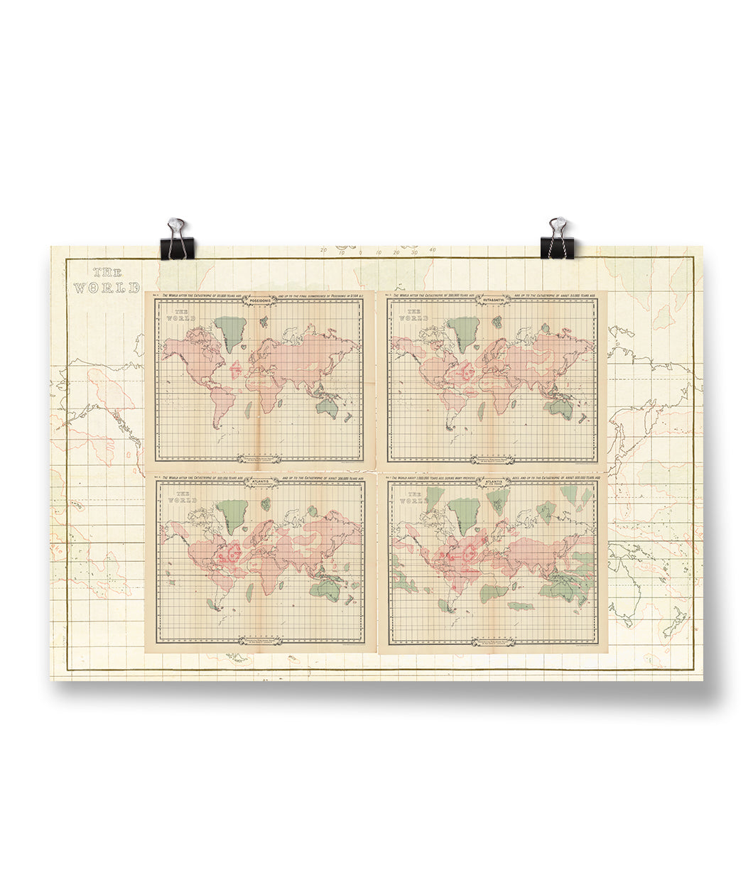
A poster showcasing William Scott Elliot's collection of maps tracing the legendary rise and fall of the lost civilization Atlantis. Made from scans of the original prints from 1900.
Explore an alternative view of Earth’s geological history. These maps show a history very different from the widely accepted history of Pangea eventually shifting into the continents we have now. They detail the great catastrophes the world went through that shaped the continent of Atlantis and eventually sunk it into the Atlantic ocean.
A great reminder that just because you mapped it doesn’t mean that it really happened.
Ideal for lovers of mythology, history buffs, and map enthusiasts alike.
Poster print on archival matte paper sized at 35.5" x 23.5"
6 Month Return Policy
Atlantis Map Print

ABOUT THE CREATOR
Johnny Harris
Johnny Harris is a one-man-band filmmaker and journalist. Formally educated in international relations and self taught as a cinematographer and motion graphics artist, Johnny uses visual storytelling to bring viewers to new places and show them why things happen the way they do. Johnny’s visual style relies on cinematic videography, beautiful digital cartography, and rigorous journalism to make even the most complicated issues accessible to a broad audience.
- Related products
- Recently viewed


